
Bhutan Geography
This page focuses on both natural and political Bhutan geography. The Kingdom of Bhutan is a landlocked country located in the Eastern Himalayan Slopes. The country’s name Bhutan is arrived from the Sanskrit word Bhu-uttan which means highland. Bhutan is bordered by China in the north and India to the east, west and south. Bhutan is also known as Druk Yul to the inhabitants meaning the land of the Thunder Dragon and has an total area of 38394 Sq. km. Bhutan is located between the longitudes 88 ̊ 45` and 92̊ 10’ east and latitude 26̊ 40’ and 28̊ 15’ north. The Kingdom of Bhutan came to be known to the outer world only a few decades ago and it is known as the Last Shangri-La.
The Natural Geography of Bhutan
Geographically Bhutan can be divided into three main zones. They are the Northern Highlands, the Central belt and the southern foothills.
The high himalayan mountains dominate the northern territory. These includes mountain peaks rising up to 7000 meters. And consists of high mountains such as Mountain Jumolhari, Gangkar Puensum, Masagang, etc. Mountain Gangkar Puensum is the highest unclimbed mountain in the world at 7570 m. The weather is extreme in these areas. There is the high peaks have perpetual snow and cold blizzards. Just below is the alpine vegetation comprising mostly of dwarf rhododendrons, moss, lichen and other flowering plants. Many interesting and rare animals are found in these forests of Bhutan such as wild sheep, wild goats, snow leopard, musk deer, brown bear, etc. are found. It is said that this northern zone is also home to the snow man or Yeti. The present generation has not seen this. Perhaps this rare beast is becoming extinct now and has always been a interesting topic when conversed about Bhutan geography, flora and fauna.
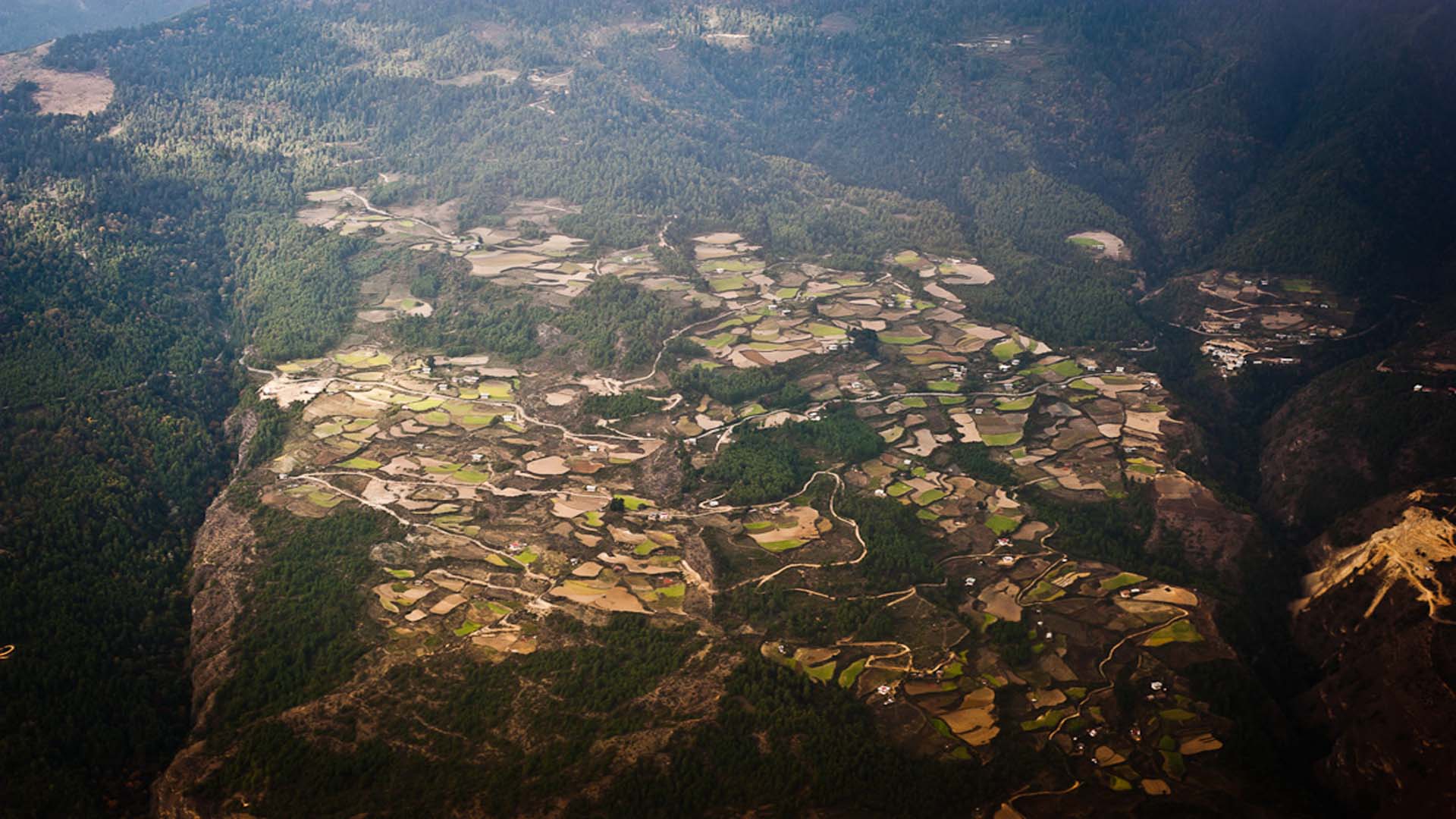
The central belt consists of the beautiful valleys in Bhutan from east to west. This includes the Thimphu valley, the capital of Bhutan. The other valleys are Paro, Haa, Wangduephodrang, Punakha, Trongsa, Bumthang, Mongar and Trashigang. The altitude varies from 3000 ft. to 10000 ft. above the sea level. This is a temperate zone and coniferous forest of birch, pine, rhododendron, oak, etc. is found. These part of Bhutan has sub alpine conifer forest at higher elevations and Himalayan board leafed vegetation at lower elevations and is one of the most populous zone. The winters are cold here and the summer are hot. Because these valley are located between the smaller himalayan mountain ranges the rainy season is accompanied with frequented landslides. Every valley is characterized by a river flowing which later meet India’s Brahmaputra River. All there valleys in Bhutan are linked by a series of Passes. Locally these Passes is known as “La”.
The southern foothills include all the southern ranges from east to west. This area has dense vegetation. This includes mostly the tropical deciduous forest. The altitude varies up to 3000 ft. above sea level. These area is largely, producing mostly rice. The maximum of Bhutan’s arable land is found in these parts and the whole of this area borders India.
The Political
Bhutan is divided into twenty dzongkhags (districts). These dzongkhags are; Paro, Haa, Thimphu, Samtse, Chhukha, Punakha, Wangduephodrang, Gasa, Dagana, Tsirang, Sarpang, Trongsa, Bumthang, Mongar, Trashigang, Lhuntse, Trashiyangtse, Pemagatshel, Zhemgang and Samdrupjongkhar. Some of these dzongkhags are further divided into Dungkhags (sub districts). All the dzongkhags are further divided into gewogs (village blocks). There are twohundred and five gewogs as of now. And the Gewogs are further divided into Chiwogs (group of villages) and thromdes (municipalities)